

Coastal Morphology Group • Scripps Institution of Oceanography
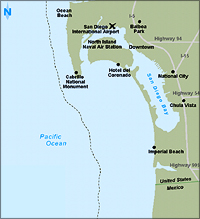
Silver Strand littoral cell
 he cell extends from Point Loma 26 km to the international border and 80 km farther south to Ensenada, Mexico. Before dam construction, the major sediment source was the Tijuana River. The U.S. portion of the cell is unusual in that sediment transport is mainly northward in the lee of Point Loma and supplies sand to the Silver Strand. This narrow barrier of sand is the western landform enclosing San Diego Bay, the largest natural bay in southern California.
The richness of the bay and adjacent kelp forest off Point Loma is difficult to imagine today.
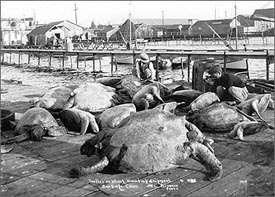 Image used with permission from The San Diego Historical Society, http://www.sandiegohistory.org. 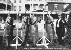 Image used with permission from The San Diego Historical Society, http://www.sandiegohistory.org. |
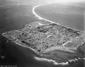
Image used with permission from The San Diego Historical Society, http://www.sandiegohistory.org.
Archaeological sites adjacent to the modern bay tell us bay environments existed in the vicinity of Imperial Beach by about 7,000 years ago. Whether the strand had enclosed the bay in its modern configuration by that time is not clear - numerous streams and faults had produced channels and basins in which rising marine waters could form small embayments.
Click on the map for interactive maps.
The first evidence of the Silver Strand comes from an archaeological site with Pismo clam shell dated to 5,000 years ago. This encampment on the southern part of the strand was intermittently occupied until modern times. Much like the Oceanside cell, the Silver Strand cell may have been starved of sand during the 8-5,000 dry period, and the Tijuana River may not have delivered sufficient sand to the coast to build the strand until the intensification of El Niño climate in the past 5,000 years.
However, strong El Niño events bring destructive waves directly in to the Silver Strand from the west. It is possible that intense El Niño periods during the past 5,000 years - or even a tropical storm - could have breached the strand and disrupted bay circulation. Certainly, with a 50 cm rise in sea level by the end of this century, such events may be expected to recur. Once a southern entrance has opened, northerly transport of sediment will shoal the bay and prevent tidal flushing. It would also provide an entry for high energy ocean waves that damage harbor installations and cause flooding. Only massive nourishment projects, totaling more than 26 million m3 over the past 60 years, have prevented erosion of Coronado beaches and the strand itself. More will be needed in the future if sediment flux out of the Tijuana River basin is not restored.
However, strong El Niño events bring destructive waves directly in to the Silver Strand from the west. It is possible that intense El Niño periods during the past 5,000 years - or even a tropical storm - could have breached the strand and disrupted bay circulation. Certainly, with a 50 cm rise in sea level by the end of this century, such events may be expected to recur. Once a southern entrance has opened, northerly transport of sediment will shoal the bay and prevent tidal flushing. It would also provide an entry for high energy ocean waves that damage harbor installations and cause flooding. Only massive nourishment projects, totaling more than 26 million m3 over the past 60 years, have prevented erosion of Coronado beaches and the strand itself. More will be needed in the future if sediment flux out of the Tijuana River basin is not restored.
Coastal Morphology Group • Scripps Institution of Oceanography
©2002-2004 by the Regents of the University of California and the Kavli Institute.
All rights reserved.
Last modifed Tuesday August 30, 2005